 http://www.newluxuryfeed.com/trimble-navigation-device/
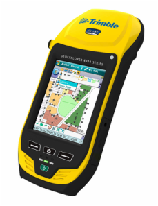
The GPS and GIS Application class is a senior and graduate level class for Biosystems Engineering students. In this class, we learned how to navigate with the Trimble receiver, log data points with the receiver, and create dictionaries that could be used in data collection. We also learned how to post process the data using pathfinder software and then create maps with AutoCAD.
We also discussed the difference in post processing and real time kinematic correction. The real time kinematic data correction is an extremely valuable resource for mapping, surveying, and farming. Prior to this class, I knew tractors and heavy machinery had started using GPS to improve efficiency but I did not know how it worked. This class taught me not only how it worked, but also how to set up a station and use it for any application.
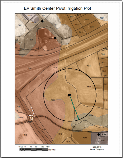
We also learned how to take data collected from the rovers and place it on a map in ArcMap to gather information about an area. One example of this was our investigation of a center pivot at the E.V. Smith Research Laboratory. We took information gathered from a Trimble rover and used it to size the center pivot on a field. We then used AutoCAD to build a center pivot with exact dimensions and the center pivot was then laid on the map of the E.V. Smith Research Lab. The picture of my final map is below.
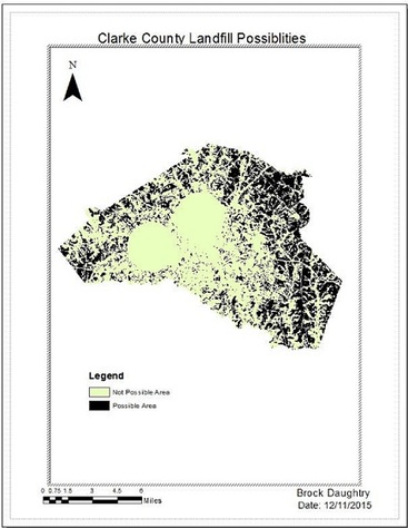
Another major aspect of the GIS class is learning to use ArcMap to complete different tasks. For one lab, we were assigned to find a new viable site for a landfill in Clarke County, Georgia. We were given a set of files that included the streams in Clarke County, a land use file, the site of ground water recharge areas, and a digital elevation map. We were also given different state and county regulations for the location of a new landfill. We used these files and different tools in ArcToolBox, such as reclassify, the raster calculator, slope, buffer, and erase, to design a map with all the viable areas for a new landfill. A copy of this map is also shown below.
We also discussed the difference in post processing and real time kinematic correction. The real time kinematic data correction is an extremely valuable resource for mapping, surveying, and farming. Prior to this class, I knew tractors and heavy machinery had started using GPS to improve efficiency but I did not know how it worked. This class taught me not only how it worked, but also how to set up a station and use it for any application.
We also learned how to take data collected from the rovers and place it on a map in ArcMap to gather information about an area. One example of this was our investigation of a center pivot at the E.V. Smith Research Laboratory. We took information gathered from a Trimble rover and used it to size the center pivot on a field. We then used AutoCAD to build a center pivot with exact dimensions and the center pivot was then laid on the map of the E.V. Smith Research Lab. The picture of my final map is below.
Another major aspect of the GIS class is learning to use ArcMap to complete different tasks. For one lab, we were assigned to find a new viable site for a landfill in Clarke County, Georgia. We were given a set of files that included the streams in Clarke County, a land use file, the site of ground water recharge areas, and a digital elevation map. We were also given different state and county regulations for the location of a new landfill. We used these files and different tools in ArcToolBox, such as reclassify, the raster calculator, slope, buffer, and erase, to design a map with all the viable areas for a new landfill. A copy of this map is also shown below.
|
|
